Trailways
Backcountry Trails
The information provided here has been reproduced from the website of The Musquodoboit Trailways Association.
There are several backcountry trails off the main rail trail accommodating a wide variation of difficulty.
The Admiral Lake Loop:
This backcountry loop offers a strenuous hike, with several steep climbs and panoramic viewpoints. Beginning at the 1.7 km mark of the rail trail, The Admiral Lake loop runs together with Bayer Lake loop for a hundred metres.
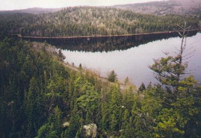
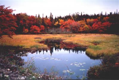
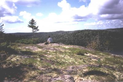
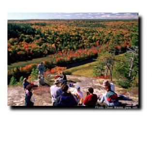
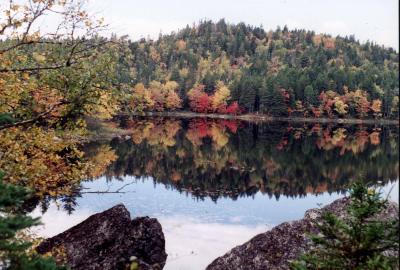
The 5 km. Admiral Lake trail continues to the right, soon climbing into an open area of blueberry bushes and low saplings, reminders of a forest fire that swept through these woods in 1973. On your left a side trail leads to a local landmark, Skull Rock. The Admiral Lake loop continues to the right, soon leaving the burn area behind to climb steeply through mossy woods to another popular lookoff, Rolling Stone (so named for the huge boulder perched precariously on its top). It and the nearby Harbour lookoff offer spectacular views over ocean, village, harbour, inlet and coast as far as Lawrencetown to the south. Descending from the Harbour lookoff, the loop trail passes through a "talus" cave where a large rock has fallen from a cliff, leaving a natural archway. Returning to the open burn area, the path climbs gradually towards Admiral Lake lookoff. Pause at this half-way point to enjoy a 180 degree panorama over the White Lake Wilderness area, and island-studded Admiral Lake. Below this high point the trail returns to the mature woods, skirting Eunice Lake alongside a cliff, before winding its way to Jessie's Diner, which overlooks Bayer Lake and the Musquodoboit River stretching northward. Return to the rail trailway below Jessie's Diner.
These trails begin on the rail trail at km. 2.5 and continue to Kelly Junction and then on to Gibraltar Rock. These are challenging trails with punishing climbs but with spectacular rewards to those up to the task. We highly recommend that you treat these as two separate trails and do only one at a time.
North Granite Ridge Trail:
This is the north half of the White Lake Wilderness Ridge Trail. Beginning at Normais Place at Kelly Meadow, the connector trail leads upward to Kelly Junction. The trail leads northerly across two lookoffs and then down to Meadow Brook, the outlet creek of Collins Lake. Descending toward Meadow Brook the trail crosses the White Lake Portage. A well worn portage is also present along Meadow Brook. The trail continues northward across several lookoffs and then enters Kimberly Clark Inc. land at Km 5.9 as measured from Kelly Junction. Crown lands are once again entered at Km 6.9. The trail intersects with the Gibraltar Rock Loop Trail at Km 9.2. From the junction to the Rail Trail it is a distance of approximately 120 metres. It is another 1.2 km to the Gibraltar parking lot.
South Granite Ridge Trail:
This is the south half of the White Lake Wilderness Ridge Trail. It begins on the rail trail at at the north end of the Admiral Lake loop trail - Km 2.5. A 2.5 km connector trail leads to the White Lake Wilderness area which you enter just past the site of the Admiral Lake look off. The trail then proceeds northerly across several lookoffs and around the north end of Granite Lake and then parallels MacDougall creek where it then joins with a portage trail. The trail again heads northerly across several more lookoffs where it then joins the half way connector trail at Kelly Junction. The connector trail leads down slope to where it joins the rail trail near Normais Place, the halfway Picnic Shelter. It is an easy 7.3 km back to the parking lot